By
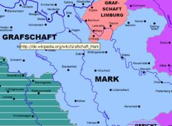
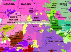
clicking on the name of a territory, e.g. GRAFSCHAFT MARK or County of Mark, you come
directly to the Wikipedia article of the chosen territory or the noble
house reigning in that territory but very small lordships are not
included.
- The map of the Empire is interactive. It allows you to access the wanted map by klicking onto the desired area.
- The same goes for the map of Northrhine-Westphalia.
- The navigation arrows also lead to the neighbouring maps.
- By
using the functions of the Acrobat Readers© you can display a list
of the maps and a table of contents that allow navigation.
- The maps can be printed in different sizes dependent on your printer. They were optimized for the A3 size (11 1/2" x 16 1/2")
- Of course you can use the zoom function of the Acrobat Reader©.
- All maps are of much higher quality than the gif-format maps on the internet (see the demo version).
Note:
These maps show the territorial situation in
Germany in 1789. We have now the year 2006 – the Holy Roman Empire of
the German Nation ceased to exist 200 years ago. The maps were not
drawn to show any territorial claims or demands.
The maps may be used for private and educational purposes. None of the
maps may be used for any printed or electronic publication without
written permission. © Copyright 2006 by Thomas Höckmann.
No responsibility can be taken for he contents and the quality of the
Wikipedia articles. For further information please contact: info@hoeckmann.de
Deutschand 1789 - Interaktiv includes the following maps:
|
|
The Holy Roman Empire of the German Nation
| Bishopric of Cologne
|
|
Bavaria
| Lower Rhineland
|
| Swabia (Bavarian part) | Bishopric of Münster – Southern part |
| Swabia Northern Part
| Minden-Ravensberg and Lippe
|
| Baden-Wurttemberg Southern Part
| Bishopric of Paderborn and P. of Waldeck
|
| Baden-Wurttemberg Northern Part
| Duchy of Westfalen
|
| Palatinate
| Ruhr area
|
| Saarland
| Siegerland
|
| Rhineland-Palatinate
| East-Prussia and West-Prussia
|
| Hesse Southern part
| Limburg and Liège
|
| Hesse Northern part
| Luxemburg
|
| Saxony - Thuringia – Anhalt
| Flanders and Brabant
|
Brandenburg
| Lorraine (1648)
|
Silesia (1763)
| Alsace Southern Part (1648)
|
Pomerania
| Tyrol (1766)
|
Mecklenburg
| Austria
|
Schleswig-Holstein (1730)
| Baltic countries 16. century
|
Lower-Saxony
| Baltic countries end of the 17. century
|
| South-Western part of Lower Saxony | Baltic countries end of the 18. century
|
| Niederstift Münster | Legend and abbreviations
|
| Northrhine-Westphalia |
|

