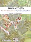
| The Ancient Rome Vector Map - ROMA ANTIQUA: Rome and the Seven Hills with contour lines |
| Inside |
|
| description |
|
| Terms |
|
|
|
|
| Customer Care |
 |
The Ancient Rome Vector Map by Christos Nüssli Price: 30 euros by direct download or 50 euros on CD-ROM (+ VAT) See the End-User License Look inside Download a sample file - 5.39 Mb Web version |
|
|||||||||||||||||||||
| Description |
A
vector map of ancient Rome in year 100 AD with contour lines, public
and private buildings, roads, woods, gardens and labels. The map allows
the display of the Seven Hills only with the prehistoric villages
existing before the emergence of the city. |
Read the End-User license please |
|||||||||||||||||||||
| Platform |
Windows 95 / 98 / NT / 2000 / Me / XP / Mac OS |
||||||||||||||||||||||
| System requirements |
- PC or Mac. - Corel Draw 10 or higher or Adobe Illustrator 8 or higher required. - The map is provided in Corel Draw 10 and Adobe Illustrator 8 CMYK formats. |
|
|||||||||||||||||||||
| Main features |
|
Direct download After payment by credit card and you will receive immediately a download link with login and password for the compressed file (.zip) weighting 13 MB and containing both Corel Draw 10 and Adobe Illustrator 8 format of the Ancient Rome Vector Map together with the license in English and French.The link will be valid for 24 hours. You will need tu unzip the file using Windows or Winzip. If you select physical shipping, you will receive, in addition, a CD-ROM copy of the product. Get Winzip |
|||||||||||||||||||||
| Spotlight reviews |
"My
father also sent along this interactive map of Rome c. 100 CE, which
comes with or without text labels (in English or French). The
possibilities for role-playing games, etc., just get better and
better." Vanessa T. |
||||||||||||||||||||||