|
|
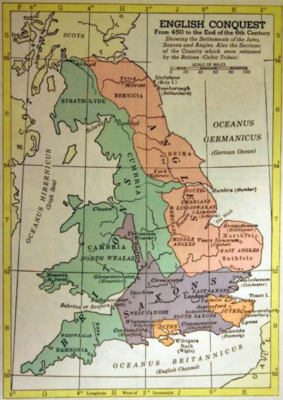
English Conquest from 450 to the End of 6th cent.
Hammond Historical Atlas of the World, Maplewood N.J. 1976, p. H-10
|

|
This
is a semi-mythical map, more or less connected to Vortigern, Hengist
and Horsa. No political entities are shown, only wide-coloured areas.
From the map, the reader is led to believe in the presence of three
homogeneous and related groups called Saxons, Jutes, and Angles who
fought against a fourth, unrelated group, called Britons.
In fact, the 5th century was a period of semi-anarchy in the British
Isles. Although our knowledge of the Anglo-Saxon settlements at this
time is poor and often legendary, it appears that the tribes
mentioned here were competing with each other and that they changed
alliances regardless of their group belonging.
|
|
|
|